Tropical Depression Fred Discussion
NWS National Hurricane Center Miami FL
0800 AM EDT Fri Aug 13, 2021
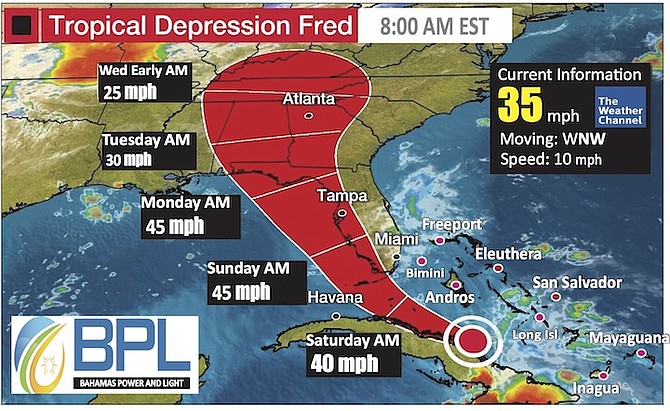
Fred continues to produce heavy rains across eastern Cuba and portions of the south-eastern Bahamas this morning. However, despite the areas of heavy rain, the system remains poorly organized. Most of the deep convection is located to the east of the center and there is little evidence of banding features. The NOAA and Air Force Hurricane Hunters will be investigating Fred later this morning, and the data both planes collect, will determine Fred's intensity
Fred continues to move west-north-westward at about 9 kt. This motion should persist for about another day as the storm continues to move in the flow on the southwest side of a subtropical ridge.
After that time, a turn to the northwest and then the north is predicted as Fred moves around the western side of the ridge.
Based on this expected motion, the storm should track just north of eastern and central Cuba through tonight and the Florida Keys on Sat.
KEY MESSAGES:
1 From today into Monday, heavy rainfall could lead to areal, urban, small stream, and exacerbated river flooding, across southern and central Florida into the Big Bend. From Sunday onward, heavy rain and flood impacts could extend into other portions of the Southeast and into the southern and central Appalachians and Piedmont.
2 Tropical storm conditions are expected in the Florida Keys onSaturday, where a Tropical Storm Warning has been issued.
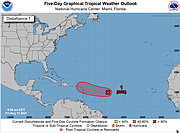
3 Watch out of Invest 95L which has 80% chance of becoming a named storm within the next 24-48hours. That one needs watching!!


Comments
Use the comment form below to begin a discussion about this content.
Sign in to comment
Or login with:
OpenID